EV Fleet Management Software: Track & Optimize Efficiency

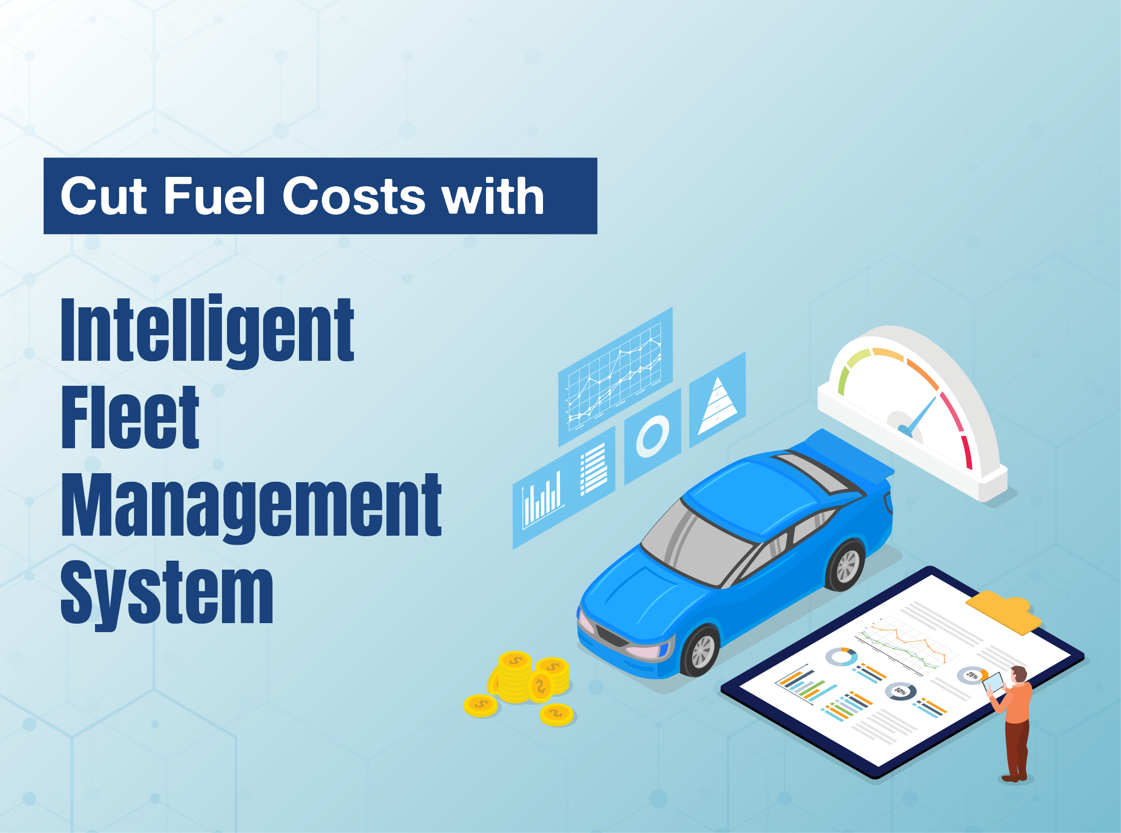
What if every logistics vehicle could run efficiently and could easily navigate through busy urban traffic? Delivery vans could quietly glide through the city streets, transit buses could run with eerie precision and predictability, and corporate vehicles could easily anticipate their drivers’ every need. Well, it’s not merely a thought of the moment. It’s the reality of modern logistics. Businesses are already using Electric Vehicle Fleet Management Software, that made it all possible.

People are reducing their dependence on fossil fuels because not only is it costly, but it is also harmful for the environment. That’s the reason, nowadays, they are switching to electric mobility as it is more sustainable and efficient. However, to manage EVs efficiently, modern tech such as EV fleet management systems is necessary. It will monitor, analyze, and optimize every aspect of electric vehicle operations. Hence, your EV fleet business will be more efficient, sustainable, and reliable.

Why Your EV Fleet Needs It?

No matter how efficient EVs are, if you aren’t managing it properly, they will never meet their potential. Managing a fleet isn’t easy and it includes many challenges. Let us tell you common issues such as, ‘Will the battery last the whole route?’, ‘When should charging happen to minimize costs, and maximize uptime?’, ‘What happens if the van stalls with a depleted cell in a delivery crunch?’ These common scenarios not only halt the operations but also hinder the growth of your business. Electric Vehicle fleet management software can tackle all these riddles. These fleet management systems will be a virtual brain for your EV fleet and will juggle thousands of real-time variables to keep operations smoothly going.

Know The Tech!
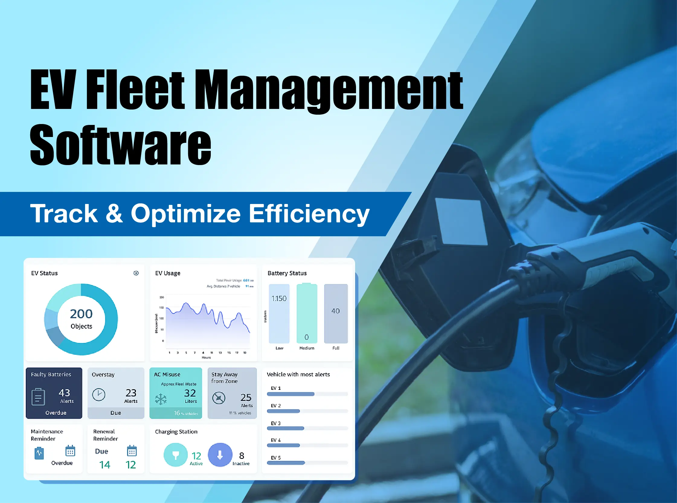
So, what is this EV fleet management software and how does it work? This fleet management system is a digital platform that uses smart technologies such as IoT sensors, AI-driven analytics, cloud integration, and real-time tracking to meet every requirement of electric vehicles. Electric vehicle fleet management systems keep an eye on every aspect of your EV. Fleet EV charger management software can tackle challenges like battery monitoring, smart charging, range planning, and smooth integration with charging infrastructure. Let’s see what technology is behind this super-efficient IoT fleet management!

  • IoT Sensors & Real-Time Telemetry
  • Each electric vehicle in your fleet will be equipped with IoT sensors. These sensors constantly collect data related to the vehicle’s speed, exact location, battery charge level, and even things like tire pressure or temperature in real-time.

  • AI-Driven Analytics
  • These intelligent IoT fleet management solutions use AI to quickly study all the data from the vehicles. Hence, saves a lot of time. These smart systems look for patterns and trends. The AI algorithms dissect the information and provide detailed analytics on routing, charging, and scheduling.

  • Automated Charging
  • The Fleet EV charger management software automates charging. It gives you reminders and can schedule charging as soon as it notices the drop in battery levels. It makes sure every vehicle is fully charged and ready.

  • Driver Behaviour Insights
  • The electric vehicle fleet management system keeps an eye on driver behaviour. It tracks how each driver operates the vehicle and monitors activities acceleration, harsh braking, idling times and speeding. It provides detailed feedback and reports on driver behaviour so your drivers can work on such inefficiencies. This helps them adopt habits that are safer and better for the vehicle’s battery life.

    Features of Electric Vehicle Fleet Management

    1. Real-time State of Charge and Range Monitoring:
    2. The electric vehicle fleet management software provides a live dashboard of every vehicle’s battery level. Also, it calculates a vehicle’s remaining range according to battery levels and by analyzing real-time data like route, terrain, vehicle load, and driver behaviour. This kind of proactive insight prevents operational risk and reduces anxiety.

      Aspect Details
      Live Battery Levels You can see the current charge for every vehicle through the dashboard
      True Range Prediction Calculates accurate range based on real-world conditions
      Proactive Alerts Notifies you when vehicle’s charge is low
      Prevents Failures You can avoid costly roadside issues as dead battery

    3. Intelligent Charging Management:
    4. This feature of electric vehicle fleet management can save a lot of money, especially when it comes to battery charging. The software can automate charging schedules according to battery levels and save a lot of time. This way, it negates unnecessary breakdowns and unnecessary battery replacement needs. For depots, it intelligently balances the power load across multiple chargers to avoid overloading the grid and incurring expensive penalty fees. It ensures all vehicles are ready for their next shift and are fully charged.

      Aspect Details
      Time Efficiency Schedules charging and save time
      Optimizes Uptime Ensures the vehicle is fully charged and ready
      Locate Public You can locate nearby charging stations if your
      Chargers vehicle’s battery is running low

    5. Battery Health and Performance Optimization:
    6. An EV’s battery is its most expensive part, and that’s why you need to maintain proper battery health. You can easily monitor your EV’s battery health and use the software’s smart charging features. It means don’t let you battery drain completely. You can schedule smart charging through this software. It identifies the drop in battery levels and smartly manages the charging to maximize its lifespan. These preventive practices will help your batteries from degrading.

      Aspect Details
      Monitors Battery Health It tracks degradation and performance over time
      Extends Battery Lifespan Encourages smart charging habits
      Lowers Replacement Costs Reduces wear and tear, and schedules, easy maintenance
      Protects Resale Value A well-maintain EV battery and EV remains a great asset for you

    7. Predictive Maintenance:
    8. Electric vehicle fleet management software provides you with reactive, schedule-based maintenance through proactive, data-driven, detailed insights. It continuously analyzes operational data and can identify even minor shifts in battery performance. These insights help you find out inefficiencies and possible failures weeks or even months before. Hence, not only can you prevent accidental breakdown but also manage your business better way.

    Aspect Details
    Proactive Alerts It uses data analytics and analyzes when maintenance is needed
    Remote Diagnostics Real-time troubleshooting, provides performance data, improves time-efficiency and saves money on repairs
    Prevents Unexpected Breakdowns Helps avoid disruptive failures, identifies inefficiencies

    Make Your EV Fleet Efficient Than Ever!

    An electric fleet without intelligent software will never achieve the efficiency you anticipate for your business. There is so much potential your EV fleet business can achieve. The electric vehicle fleet management software can help EV management companies achieve the efficiency they wish for their business. These intelligent platforms use real-time data with automation and analytics, and make your operations smooth and scalable. If you are looking for vehicle management software, SpincLabs can help you with it.

    FAQ’s

    What is a Fleet Management Software?
    It’s an advanced digital platform that can monitor, analyze and optimize every aspect of your EV fleet, using technologies like AI, IoT and real-time tracking. It keeps an eye on battery charging, battery health, maintenance and driver behaviour.

    How does this software prevent mid-journey breakdowns?
    Since the software is capable of real-time state of charge and range monitoring, it can calculate predictive range of your vehicle. AI analyzes route, battery’s health, and calculates possible breakdowns before the journey.

    What is predictive maintenance and how does it work?
    An EV fleet management system collects and analyzes every aspect of your vehicle such as tire pressure, battery health, and charging status. This way it can predict when maintenance is needed and provides schedule-based maintenance.

    Can this software help improve my drivers’ performance?
    Yes. The system keeps an eye on driver behaviour such as harsh braking, acceleration, and excessive idling. It provides detailed feedback and reports that you can use for driver coaching. Hence, improves safety and also helps drivers to perform better.

    How secure is my fleet’s operational data with this software?
    All your data transmitted from the vehicles to the cloud remains encrypted. Our platforms use secure cloud infrastructure that requires user authentication with different permission levels. Hence, our EV fleet management software ensures that only authorized personnel can access sensitive operational information.

    AI + AR in Indoor Mapping: Smarter Indoor Wayfinding

    Do you feel frustrated and experience a familiar prick of anxiety whenever you navigate through airport terminal, a hospital, or a shopping mall? Here, in such complex spaces GPS signals falter easily, and static maps prove useless. Worry not because solutions like ‘Smarter Indoor Wayfinding through AI+AR in Indoor Mapping is solving all your complex navigation issues. These solutions are transforming complex indoor environments navigation. This way, your smartphone not just tells you where to go, but showing you the way, overlaying precision, directions directly onto your real-world view. Let’s see how AI+AR is building intelligent and self-updating spatial awareness.

    Artificial Intelligence and Augmented Reality are the most common tech we use nowadays. In complex indoor environments like college campuses, industrial plants, airports, hospitals, shopping malls, and corporate campuses, easy navigation becomes quite difficult.

    AI+AR is now transforming this hazy experience and turning static floor plans into digitized accessible maps. These maps become the interactive guidance systems that negate the confusion and chaos. AI’s ability interpret spatial data and AR overlays digital directions, hence, in this way, indoor wayfinding becomes smarter and more accurate.

    Intelligent Indoor Mapping Through AI

    Creating digitized maps has become easy through AI algorithms. With the use of computer vision and machine learning models, AI systems can digitize existing floor plans. It can automatically detect architectural features of a place, such as doors, walls, corridors, and points of interest, with accuracy. This way, indoor wayfinding becomes precise and easy.

    Unlike static floor plans, where certain things remain outdated, AI-powered systems continuously update maps in real-time by analyzing sensor data streams. If there is a change in layout, they detect it instantly. Similarly, when a hallway closes for maintenance or a new kiosk appears, the system can automatically detect these changes and update navigation routes within minutes. Features include-

    • Bluetooth Low Energy (BLE) beacons for proximity detection
    • Wi‑Fi positioning systems using received signal strength indicators
    • Ultra‑wideband (UWB) technology for centimeter‑level accuracy

    Smarter Wayfinding Through AR

    By overlaying digital navigation cues directly onto the user’s real-world view through smartphone cameras or AR glasses, these systems make directions immediately comprehensible. This means users can see floating arrows, directional lines, and distance markers that appear to exist in the physical space around them.
    This innovative tech dramatically reduces the cognitive load required for indoor wayfinding. Hence, users no longer need to mentally translate 2D maps into 3D movements through complex spaces. Features include-

    • Dynamic obstacle detection and route adjustment
    • Recognition of landmarks
    • Adaptation to changing physical layouts without manual updates
    • Integration with live data sources for real-time information

    Technologies in AI+AR

    When we navigate through AI+AR, computer vision and sensor fusion algorithms become the brain of our entire operation. It doesn’t rely on external signals; it learns to understand the environment itself. Let’s see how!

    Visual Positioning System (VPS):

    Instead of satellites, VPS uses the smartphone’s camera as its primary sensor. Yes, AI is trained on a 3D map or a dense library of images of the indoor space. This means by analyzing the live camera feed, AI can identify existing features and match them to the map so you get hyper-accurate, sub-meter localization in real-time. It’s like facial recognition, but for places.

    Intelligent Pathfinding:

    AI elevates route planning beyond just finding the shortest path in indoor wayfinding. Machine learning models can calculate the optimal path based on the following factors:

    • Real-time conditions
    • User preferences
    • Predictive routing
    Tech Function in Indoor Mapping Benefit
    Sensor Fusion Combines BLE, Wi-Fi, UWB, and IMU data Achieves sub-meter position accuracy
    SLAM algorithms Real-time mapping and localization Easy navigation
    Cloud Integration AI model updates and data sync Enables continuous system improvement and scalability
    Edge Computing Local processing for reduced latency Enables Real-time AR with improved response time
    Machine Learning User profiling, pattern recognition, route optimization Improves accuracy through constant learning


    Are We Already Using The Tech?

    After reading this all, you are wondering, ‘Are we even using such tech, or is this mere fantasy?’ No! This isn’t just a hypothesis; we are using it at various places. Yes, AI-powered AR wayfinding is being deployed across numerous sectors, such as the following!

    From busy airports to delivery fleets, the integration of AI, AR and IoT is no longer a daydream; it’s a reality of our daily lives. Today, millions of people benefit from these technologies, often without realizing it. Indoor navigation apps guide travelers through complex terminals using AR overlays, while logistics companies rely on IoT sensors and AI-powered analytics to optimize routes, monitor vehicle health, and prevent costly delays. These innovations are quietly embedded in the systems and services we interact with, making navigation smarter, operations more efficient, and experiences more seamless than ever before.

    • Airports & Transit Hubs

      Smarter indoor wayfinding in busy transportation hubs like airports is helpful in negating the hassle.

    • Retail & Malls

      Enhancing the shopping experience with product-finding features and location-based marketing.

    • Hospitals & Healthcare

      Helping patients and visitors navigate complex facilities, ensuring they arrive at appointments on time and with less anxiety.

    • Corporate Campuses & Universities

      Onboarding new employees and students by helping them find meeting rooms, lecture halls, and facilities.

    • Museums & Venues

      Creating self-guided tours and interactive exhibits that engage visitors in new ways.

    • Warehousing & Logistics

      Guiding workers on the most efficient pick-and-pack routes, boosting operational productivity.

    Let’s Implement Smarter Indoor Wayfinding!

    AI and AR in indoor mapping are about more than just eliminating the frustration of getting lost. It’s the future of possibilities and represents the tech shift in how we interact with the built world around us. We are moving from static, passive environments to data-rich spaces. The opportunities are waiting for us as everyone is digitizing and upgrading themselves with such tech. The platforms being built today by Spinclabs will not only power the next generation of wayfinding but will also serve as the foundation for a universe of spatially-aware applications.

    FAQ’s

    What is AI + AR indoor wayfinding?
    It is an advanced tech that uses your smartphone to create a smart, interactive map of an indoor space. The AI acts as the brain, understanding exactly where you are by looking through your camera and AR acts as the visual guide, overlaying digital directions, like floating arrows and pathways, onto your live view of the real world.

    What’s the difference between this and older Bluetooth beacon systems?
    Bluetooth beacons’ accuracy is limited and they require the costly installation and maintenance of hundreds of physical devices. AI + AR wayfinding provides hyper-accuracy by using computer vision and doesn’t necessarily require any extra hardware to be installed in the building.

    Do I need special AR glasses to use this technology?
    No. While the technology is compatible with and will be incredible on future AR glasses, current applications are designed to work with your smartphone. The system simply uses your phone’s camera and screen to create the augmented reality experience.

    Is this technology safe?
    These systems are designed with privacy and is encrypted, therefore, visual data captured by your camera for positioning remains safe. Data is processed on the device or anonymized before being sent to the cloud. The system analyzes geometry and patterns for localization, not identifying people’s faces or recording personal activities. Hence, it is safe for use.

    Indoor Positioning and Indoor Navigation Use Cases

    “Have you ever lost your way inside complex spaces such as a hospital, airport, or a multi-story building due to GPS? While GPS works wonders for outdoor spaces, it fails miserably for indoor spaces. It can’t work through the thick walls and ceilings of buildings. So, how do we navigate through these complex spaces? An indoor positioning system and indoor navigation system can solve your worries as they are specially crafted for indoor navigation. Instead of using satellites, it uses signals from a building’s existing Wi-Fi network or small, low-energy Bluetooth devices to pinpoint your precise location. It gives you simple, turn-by-turn directions on a map via the indoor navigation system, guiding you step-by-step to your destination. Let’s see how this technology is transforming various industries!”

    Have you ever been lost in the complex indoor spaces and ever felt the confusion and panic to find the way out? Though technologies like GPS have made our lives easier, however, even those devices can go clueless in indoor spaces. Why? The answer is simple. A GPS signal cannot penetrate the thick walls of indoor spaces. That’s why while outdoors, we become navigation-savvy machines with the help of GPS, in complex indoor spaces, we become quite miserable. Yes, the moment we step through a doorway, we are cast back into a pre-digital age.
    However, modern advanced technologies such as the Indoor Positioning System—an effective indoor positioning system—have made it easy for us. They are capable of precise location tracking and smooth navigation within enclosed spaces. Many industries are transforming and enhancing their indoor navigation system experience with Indoor Positioning and Indoor Navigation System!

    What is Indoor Positioning and Navigation?

    As India is developing, urbanizing and upgrading its existing infrastructure, it is including the use of advanced technologies across various sectors. These technologies are improving efficiency, safety, and user experience. Unlike GPS, which struggles indoors due to signal loss, the Indoor Positioning System (this indoor positioning system) uses technologies such as BLE, Wi-Fi, Ultra-Wideband, and RFID to pinpoint locations inside buildings. This means these systems provide real-time tracking of people, assets, and workflows. Also, they provide navigation turn-by-turn guidance through mobile apps, kiosks, or augmented reality overlays enabled by the indoor navigation system.

    Tech Advantages Use Cases
    Bluetooth Low Energy (BLE) Highly compatible, low power consumption Retail navigation, employee tracking, proximity marketing
    Wi‑Fi Positioning Uses existing Wi‑Fi infrastructure, no additional hardware needed Large indoor spaces, general navigation, employee tracking
    RFID Cost‑effective and widely used, proven efficiency Access control, asset tracking
    Ultra‑Wideband (UWB) Exceptional precision, immune to interference Robotics, high‑precision asset tracking, safety applications
    Visible Light Communication (VLC) Secure transmission, high precision Museums, secure environments, high‑accuracy applications

    Use Cases

    Healthcare

    The endless corridors and departments in a hospital can be so confusing to navigate, especially when you are visiting a hospital for the first time. That’s the reason why the numbers of visitors and patients get anxious and tired, making their way through these complex spaces. With indoor positioning, their smartphone becomes a digital guide for them. This means they can see turn-by-turn directions, reroute instantly if they miss a turn, and get alerts to amenities such as the nearest elevator. This way, the indoor navigation becomes easier for them.
    Even for hospital staff, the system is super efficient. They can track the location of equipment. In emergencies, these systems can guide doctors and nurses directly to patients, which helps administrators streamline workflows and reduce wasted time.Learn more about how indoor navigation systems help hospitals in this detailed guide

    Real Use Cases

    Apollo Hospitals Network, Tata Memorial Centre (Mumbai)

    Smart Campuses and Corporate Offices

    Usually, college campuses are never easy for anyone, same goes for office spaces. New students or new hires remain confused and frustrated than ever if buildings are too complex to navigate. Smart Indoor navigation system makes sure that new hires and visitors are greeted not with this commotion.
    In smart campuses and office spaces, these systems can be accessed through phones. Hence, your phone can guide you from the main gate to the right building, up to the correct floor, and straight to their meeting room, no wrong turns, no frantic calls for help. Easy, isn’t it?
    Desk booking systems show real-time availability, and emergency drills are executed with precision, as evacuation routes adapt to blocked passages in real time. Also, you can use the occupancy data to optimize space, cut costs, and create an environment where productivity flourishes and stress melts away.

    Real Use Cases

    IIT Bombay, Infosys Bengaluru Campus

    Manufacturing and Warehousing

    Traditional manufacturing plants and warehouses always stay like a maze for everyone. Here, the operations become slower and navigation feels like a never-ending process. Modern manufacturing and warehousing setups use advanced tech, not only for people but for each machine and part. Each can be tracked in real time by ultra-wideband sensors. Forklifts glide along optimal routes, avoiding collisions and delays—thanks to the indoor positioning system. No single part ever gets lost, and critical tools are always within your access. When a safety breach occurs, the system is capable of sending you instant alerts, and you will know exactly where to intervene. Here, production lines rarely stop, and your workforce stays safe.

    Real Use Cases

    Mahindra and Mahindra Automotive Plants, Flipkart Fulfillment Centres

    Retail and Shopping Malls

    Shopping malls are huge, and we are bound to wander aimlessly just to find our desired store. But ever since big shopping malls have installed these smart navigation systems, shoppers no longer wander aimlessly. Their phones can be morphed into personal shopping assistants, mapping the quickest path to their favourite store.

    Also, you can receive alerts if there is a special sale going on at their store or any store they pass. It can even guide them to the nearest restroom or exit. Retailers can also use Indoor Positioning and Indoor Navigation System to identify or go through footfall analytics to optimize store placement.

    Real Use Cases

    Phoenix Marketcity (Mumbai), DLF Mall of India (Noida)

    Airports and Transportation Hubs

    Indian airports receive so many visitors in a day. Airport is a place of chaotic crowds, families with luggage, business travellers racing against the clock, and first-time flyers overwhelmed by the enormity of it all. Indoor navigation—powered by the indoor navigation system—can transform the whole experience and can turn this chaos into a smooth experience. Through these advanced systems, passengers receive real-time updates about their navigation. If someone has reduced mobility, these indoor positioning and indoor navigation systems are capable of guiding them to accessible paths. Also, digital signboards and AR overlays help non-English speakers find their way.

    Real Use Cases

    Kepegowda International Airport (Bengaluru), Delhi Metro Rail Corporation (DMRC)

    Public Safety and Emergency Response

    Emergency responses should be quicker because when a disaster strikes, it’s all that matters most. Indoor positioning becomes a saviour when it comes to such things. Whether there is a fire in a high-rise or a medical emergency in a crowded station, indoor positioning can help you greatly.
    It can help firefighters track each other’s locations through thick smoke, and can ensure no one is left behind. Evacuation apps can guide panicked crowds to the safest exits. These systems mean faster rescues, fewer casualties, and new possibilities of data-driven emergency response.

    Real Use Cases

    Mumbai Fire Brigade, Indian Railways

    Let’s Transform Indoor Spaces!

    Indoor positioning and navigation are transforming our daily life and our most complex spaces. From hospitals that save lives more efficiently to malls, factories to warehouses, these systems—with this indoor positioning system and indoor navigation system—are making our spaces smarter, safer, and more navigable.

    FAQ’s

    What is an Indoor Positioning and Indoor Navigation System?
    Indoor Positioning and Indoor Navigation System uses various technologies to accurately pinpoint the location of people or objects inside complex indoor spaces. It provides turn-by-turn navigation and real-time tracking through devices like smartphones, kiosks, or augmented reality.

    How does indoor navigation help patients and visitors in hospitals?
    It provides turn-by-turn directions to departments, wards, or amenities like elevators. Also it instantly reroutes if a turn is missed. This reduces anxiety and helps people find their way easily.

    How does indoor positioning transform manufacturing and warehousing?
    Manufacturing plants and warehouses are huge and have complex structures. The system provides you with real-time tracking of every machine, part, and forklift. This helps optimize routes, avoid collisions, and send instant alerts for safety breaches.

    Why can’t we use GPS for indoor navigation?
    GPS signals get weaker when it comes to indoor navigation. They cannot penetrate the thick walls, ceilings, and other structures of buildings. The moment you step inside a complex indoor space, the signal is lost, hence, GPS navigation becomes ineffective.

    What technologies are used for Indoor Positioning?
    Indoor Positioning Systems use a variety of technologies that includes BLE, Wi-Fi Positioning, RFID, Ultra-Wideband and Visible Light Communication.

    How Do Indoor Navigation System Help Hospitals?

    “Tired of getting lost in maze-like hospital complexes? SpincLabs’ curated guide about ‘Indoor Navigation Systems’ can turn confusing mazes into intuitive, accessible spaces. Here, you can explore why GPS has its limitations when it comes to indoor spaces and how these advanced indoor navigation system provide smoother wayfinding from parking lots to patient beds.

    Let’s Learn about the indoor mapping process, key software features, and the profound benefits for patients, visitors, and staff, from improved accessibility and reduced stress to enhanced operational efficiency and emergency response. SpincLabs helps you to understand how these data-driven insights create a truly patient-centric and transform traditional hospital spaces and hospital map design  into smart hospital and digitized spaces.”

    How Do Indoor Navigation System Help Hospitals?

    Ever felt lost in a hospital? No? Well then consider yourself lucky because it often happens with people to navigate through those sprawling buildings. Sometimes, even for the people who work there! Amidst those long corridors, multiple departments, and confusing floor plans can be stressful for patients and visitors as well. Here, once again technology becomes your cue to rescue! The indoor navigation system or the digital guides smoothly turn these complex spaces into much easier navigation maps.

    This way patients, visitors and even staff can easily navigate amidst the complex maze-like spaces such as dense parking lots and different departments. Hence, these navigation systems can lead you directly to where you need to go. The importance of hospital wayfinding benefits first-time visitors as it will be less stressful and create less confusion for them.

    What is The Importance of Hospital Wayfinding?

    The hospital wayfinding can be so useful as it can enhance patient and visitor experience. At some point in time, we all have faced the dilemma of navigating a huge hospital, especially if it’s your first time or you have trouble getting around. But with advanced tech or a system that guides you, step-by-step, from the parking lot all the way to the right department, waiting room, or even a specific patient’s bed, it can be a relief. That’s what an indoor navigation system does. It is a useful way for indoor positioning since GPS can’t work indoors. It digitizes traditional hospital map design.

    These systems can be accessible on mobile apps, at kiosks, or on digital directories. They provide you with personalized routes, voice guidance, and even options that avoid stairs for those who need them. No more wandering aimlessly, no more asking for directions (and potentially revealing private information), and this is exactly how this system provides smooth, stress-free navigation. Also, it saves time and unnecessary anxiety, hence, ensuring timely arrivals for appointments. This is the importance of hospital wayfinding.

    Where GPS Fails, Indoor Navigations Can Help!

    We all know how GPS gives you access to everywhere and in many ways we have become dependent on such technology. This ‘Traditional Global Positioning System’ or GPS technology has transformed outdoor navigation and provides us with much reliable location data through satellite signals. But here’s the thing, GPS signals weaken the minute you step inside a building, especially in basements and other underground structures. Those satellite signals can’t penetrate walls, go underground, or even work well in crowded city streets. That’s the problem with GPS because such a limitation creates a kind of technological gap because we spend approximately 90% of our time indoors. Since hospital map design will consist most of indoor, the importance of hospital wayfinding becomes crucial. Now answer this, if GPS doesn’t work inside, how do we find our way around?

    Yes, with indoor navigation systems indoor positioning becomes easier. Indoor navigation can determine location and provide guidance within enclosed spaces even where satellite navigation becomes ineffective. Hence, it is solving the GPS gap where you spend a large part of your day. Also, unlike outdoor environments where GPS offers precision within a few meters, indoor spaces can achieve comparable accuracy. It’s not as easy as it sounds, but the results are pretty amazing.

    Indoor Mapping Solution and The Process:

    ‘Indoor Mapping Solution’ creates digital representations of physical spaces, hence this digitization helps you in navigating complex spaces efficiently and easily. So, how do you create a digital map of the inside of a building? The indoor mapping process begins with obtaining accurate floor plans for indoor positioning. Let’s see how the process works!

    1. Sourcing Floor Plans:
    2. The process begins with acquiring the existing architectural blueprints or CAD drawings of the building you want a navigation solution.

    3. Digitization: 
    4. These physical floor plans will be converted into digital formats (or sometimes required to create them from scratch).

    5. Geo-referencing: 
    6. The third process is to align indoor maps with real-world coordinates to enable proper positioning, meaning Geo-referencing.

    7. Identifying Points of Interest: 
    8. We should identify the points of interest and mark them as important locations such as rooms, facilities, and amenities.

    9. Creating Navigation Paths: 
    10. Defining walkable routes and navigation networks is the last step in the process of this digitization.

      Earlier mapping methods used to take days to create a map or sometimes even weeks. However, nowadays advanced solutions such as indoor mapping solutions have simplified this process of indoor positioning and navigation. These days, there are tools that can create a digital map of a building in minutes.

    What Are The Main Features of Indoor Mapping Software Solutions?

    SpincLabs’ indoor navigation system and mapping software solutions allow users to create Geo-referenced vector maps of buildings in minutes. You can just snap photos of your existing floor plans with your phone, or even just walk around the building with the app. Our software uses AI to automatically figure out where the doors, windows, and walls are, turning a complicated process into something incredibly simple. It can transform any building into a fully navigable digital space. But what are the features this software has? Let’s explore them!

    1. Wi-Fi Positioning: 
    2. It uses existing Wi-Fi infrastructure to triangulate position based on signal strength from multiple access points.

    3. Bluetooth Low Energy (BLE) Beacons: 
    4. The small, battery-powered devices emit signals received by smartphones for precise positioning.

    5. Ultra-Wideband (UWB): 
    6. It provides extremely accurate positioning through radio waves that can penetrate obstacles and provide precision within centimeters.

    7. Inertial Measurement Units (IMUs): 
    8. It combines accelerometers, gyroscopes, and magnetometers and then tracks changes in movement, orientation, and direction.

    9. Visual Positioning: 
    10. Our software has the feature of visual positioning that uses smartphone cameras and computer vision to recognize visual landmarks and determine location.

    11. Magnetic Field Mapping:
    12. Uses the unique magnetic fingerprint of buildings for positioning. It is particularly useful in environments with steel structures.

    13. Sensor Fusion: 
    14. Combines data from multiple positioning technologies to improve accuracy and reliability.

    How It Can Be Useful to Negate Hospital and Healthcare Challenges?

    There will always be a diverse population who walk through the doors of a hospital every day. Elderly patients, people with disabilities, and non-native speakers benefit from such systems as indoor navigation system provide features like high-contrast text for those with visual impairments, voice-guided directions so you don’t even have to look at a screen, and support for multiple languages. So, it gets easier for a visually impaired patient to get clear audio instructions, or a family from another country to get directions in their own language. Hence, mapping software solutions can be useful in negating hospital and healthcare challenges.

    How Does it Help?

    In Operational Efficiency and Staff Productivity:

    Every minute is precious in a hospital and every minute that a nurse spends giving directions or a technician spends searching for equipment is time taken away from patient care. Indoor navigation system reduce the burden on information desks and help staff quickly locate essential equipment like wheelchairs and ventilators. Also, new employees can quickly learn the layout of the facility and become productive members of the team with the help of this system.

    Improves Emergency Response and Safety:

    We all know how in a hospital emergency, every second can mean the difference between life and death. Indoor navigation system provide real-time routing for emergency responders, guiding them on the fastest possible path to reach patients, operating rooms, or intensive care units. Also, they can also send instant alerts and automatically reroute staff in case of fires, sudden room changes, or other urgent situations.

    Data-Driven Insights and Facility Management:

    Indoor navigation system generate data such as foot traffic, peak times, and frequently visited areas. It can be used to improve or optimize staffing levels, improve the layout of the facility, and enhance cleaning and maintenance schedules. This data-driven tech leads to better resource allocation and higher patient satisfaction, and can even improve your hospital’s rankings.

    SpincLabs’ Smart Solution For A Smart Hospital!

    The best indoor planning and navigation systems can simplify the hospital map design. They provide a detailed representation of every room, corridor, and point of interest. These systems are transforming the traditional ways of hospitals and turning them much smarter and better so that patients have a better, more friendly way of getting around a hospital!

    FAQ’s

    What is an Indoor Navigation System for hospitals?
    The indoor navigation systems are far accurate than GPS and provide step-by-step directions to help patients, visitors, and staff find their way within a complex hospital building.

    How does it work without GPS?
    Indoor navigation systems digitize the physical maps of a particular place and use a combination of tech in a process called sensor fusion. The process includes Wi-fi positioning, BLE-beacons, UWB, IMUs, Visual Positioning, and Magnetic Field Mapping.

    What are the benefits for patients and visitors?
    With indoor navigation system, patients, visitors and even staff can easily navigate amidst the complex maze-like spaces such as dense parking lots and different departments. These systems can lead you directly to where you need to go. It will be beneficial for first-time visitors as it will be less stressful and create less confusion for them.

    How difficult is it to create a digital map of entire hospital?
    In the past, this was a slow and manual process. However, advanced indoor mapping solutions like those from SpinClabs have made it incredibly simple and fast. Our software uses AI to digitize existing floor plans or CAD files automatically.

    What happens when a hospital’s layout changes? How are the maps updated?
    Updates can be made in minutes through a simple web-based dashboard. Facility management teams can close off routes, move points of interest, or edit pathways in real-time. For major changes, the same mapping process used for the initial setup can be used to quickly re-scan and update the areas. Hence, maps stay updated.

    Cut Fuel Costs with Intelligent Fleet Management System

    “The only momentum you should gain for your business is growth and scalability. Don’t let your growth momentum face hindrances because of rising fuel prices. Rising fuel costs has always been worrisome for all of us. They shrink our profit margins and make fleet operations costly. Fuel wastages triples this expense. But what if you can identify the inefficiencies with an Intelligent Fleet Management System and control this fuel wastage? Yes, it’s possible. An Intelligent Fleet Management System can transform your traditional inefficient fleet management into an fuel-efficient Fleet. Let’s explore how it can use data-driven insights and advanced technology to optimize fuel consumption!”

    Fuel prices are going up, and this brings many challenges, especially if you are managing a fleet business. Fleet owners, let us ask you a simple question, ‘How often do you feel that your business isn’t keeping up with these rising fuel prices?’ You feel the pressure and it definitely isn’t a pleasant situation. But what if we tell you that you can cut fuel costs with modern advanced tech like Intelligent Fleet Management Systems? Yes, you can easily reduce your fuel costs through it. As we all know fuel expenses can change the whole scenario for your business. It’s never easy to manage these costs since it keeps on rising. Whether your business is a small or a large enterprise, fuel expense is something that is beyond our control. Not anymore! You can control your fuel costs with an Intelligent Fleet Management System. Intrigued to know how it works, let us shed some light on it!

    What is an Intelligent Fleet Management System?

    How an Intelligent Fleet Management System can help you? Well, an Intelligent fleet management system includes several smart devices such as GPS trackers, fuel sensors, and telematics. Fleet Management IoT system gives you transparent data and visibility. Hence, it can collect and analyze every data about the fleet in real-time. This helps you keep a hawk-eye on every aspect of fleet operations. In other words, it is a digital platform for your traditional fleet system. It helps businesses monitor, manage, and optimize their fleet of vehicles using real-time data, smart analytics, and automation.

    An Intelligent Fleet Management System integrates with your vehicle systems to track fuel consumption. They keep an eye on driver behaviour such as harsh braking etc., since patterns like overspeeding and harsh braking can impact fuel usage as well as compromise your fleet’s safety.

    How Does It Help You to Cut Fuel Costs?

    But how does this help you to cut down your fleet’s fuel costs? An Intelligent Fleet Management System cuts your fleet’s fuel costs by showing you hidden inefficiencies that traditional methods miss. What are these misses? Things like driver behaviour such as harsh acceleration and braking, idling, and overspeeding. These kind of things which otherwise go unnoticed but waste the most fuel. Also, it even sends timely reminders for engine tune-ups or tire pressure checks. So, you won’t face sudden disruptions and hasty maintenance costs. As we know scheduled maintenance is less costly than unscheduled ones. An Intelligent FMS gives you its analysis and detailed report (it keeps historical data as well) that shows exactly where fuel is being wasted. This is important so you can coach drivers directly and fix problems at the source.

    Features of Intelligent Fleet Management System

    Are you still managing your fleet in a traditional way? Managing a fleet in a traditional way means endless phone calls, paper logs, and things become quite unpredictable about where your vehicles are or how they are being used. On the other hand, with an Intelligent fleet management system, all the information is gathered and shown to you in a unified platform. This means you can see which vehicles are on the road, who’s driving them and how much fuel they are using. It keeps track of everything in a single place. You can see all the real-time data about your fleet from being at a remote location. This way you gain total control of your entire fleet, spot issues early, save money, and keep everything running on time efficiently.

    Lets You Monitor and Optimize Driving Behaviour

    Very few people are aware that aggressive acceleration, speeding, and excessive idling remain the most common culprits of fuel wastage. With Intelligent FMS, you can easily monitor all these aspects in real-time and get detailed reports about the inefficiencies. Once you get to know these inefficiencies, you can work on improving them. You can plan monthly feedback sessions for drivers according to each report and create opportunities for constructive dialogue with them. These things will benefit you to achieve operational savings and reduce your fuel costs.

    Preventive Maintenance Improves Fuel Efficiency 

    Sudden vehicle breakdowns can be troublesome and disrupt operations. For fuel-efficient fleets, scheduled maintenance is necessary because it can save money as well as improve the efficiency of your fleets. Regular checks such as ensuring proper tire inflation, replacing clogged air filters, and scheduled oil changes, keep your operations in check. So, what is this preventive maintenance? Maintenance software can automate reminders for these tasks. It keeps track of every aspect of your vehicle through its advanced sensors to ensure nothing slips through the cracks. If it notices issues with your vehicle, it sends you notifications and generates data about vehicle health. This kind of prevention extends vehicle lifespans and keeps fuel consumption in check.

    Telematics Helps You Track Fuel Usage

    Advanced tech such as Telematics systems is part of Intelligent Fleet Management Systems. Whether it is about visual insights into driver behaviour or keeping an eye on road incidents through video monitoring, Video Telematics enhances safety, improves visibility and improves your fleet’s performance. Since it provides you with 360° view of every trip (powered by advanced collision detection algorithms), it improves instant incident response. Also, such Intelligent FMS uses eye-tracking to monitor driver alertness and proactively prevent drowsiness-related accidents. This way you can monitor all kinds of driver actions and behaviour including speed, acceleration and harsh braking. Telematics includes post-trip analytics, which helps you to identify risky behaviours and enable targeted training.

    Real-time Vehicle Tracking and Visibility

    You can keep an eye on every movement of your fleet with IoT-enabled GPS and telematics. Since IoT-enabled devices provide you with live updates on vehicle locations, routes, and statuses, you get constant updates showing each vehicle’s exact location. Even you will be able to see when it comes to a halt. This means complete visibility for your fleet.

    Training Programs For Your Drivers

    Let your drivers understand the importance of fuel management because fuel saving depends on their driving behaviour as well. You can organize training programs on fuel-efficient techniques like steady acceleration, minimizing idle time, and maintaining speed limits. If you want their active participation, you can introduce incentive programs. This step will boost their morale and participation.

    Staying updated is Important

    Who wants to be outdated? If you remain outdated, you will be out of the system soon. Hence, upgrading yourself and your business is equally important. An Intelligent Fleet Management IoT System is the necessity of the hour as well as for your business. It helps you cut fuel costs, reduce hassles, and help you grow your business.

    FAQ’s

    How do I get started with an Intelligent Fleet Management System?
    Before we proceed, you must identify your needs and align your budget. From enhanced features, smoother integration and consistent support, SpincLabs provides you with everything that you need to get started.

    What exactly is an Intelligent Fleet Management System?
    It’s a centralized digital platform that uses smart devices like GPS trackers, fuel sensors, and telematics to monitor, manage, and optimize your fleet in real-time. It gathers and analyzes every data about vehicle location, driver behaviour and fuel usage.

    How does it reduce fuel costs specifically?
    It identifies and helps you identify inefficiencies such as fuel-wasting behaviours (harsh braking, speeding, rash driving), provides reminders for timely vehicle maintenance (tire pressure, engine tune-ups), optimizes routes, and analyzes fuel usage patterns for improvement.

    We already use GPS tracking. How is an IFMS different?
    Basic GPS tracking has its limitations. While IFMS integrates multiple data sources (fuel sensors, telematics, driver behavior monitoring) to provide detailed view of your fleet. It analyzes the data and gives you insights to improve fuel efficiency, insights for maintenance and improves fleet performance.

    Is it just for large fleets? Will it benefit my small business?
    It is scalable which means it can benefit both small and large enterprises. While the scale of savings may vary, the principles of identifying and eliminating fuel waste apply regardless of fleet size.